I just got back from a few days in the mountains hiking with my mom and sister, so I thought I would write a bit more of my rememberances from last year.
Leaving Kennedy Meadows
After a couple of nights in Kennedy Meadows, I was ready to get back on the trail. There was a group leaving a couple hours before I would be ready, so I checked and made sure that they would be okay with me tagging along. I really didn't want to do the mountains alone.
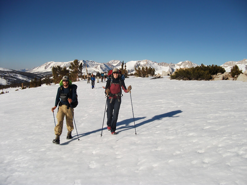
Before long, I left and hiked five or ten miles before I caught the group. The group consisted of Buffalo, Pyrite, Chinchilla, Zombiefeet, Ryan, and Sue. The first day, we didn't see any snow, but that would not last long. Our packs were much heavier than usual, since we had bear canisters to keep our food safe, and ice axes to keep our bodies safe.
We made our way into the mountains. The group was larger than I was used to, and so we hiked a bit slower than I normally did. Getting consensus that we would start hiking againg after breaks was difficult. I started to get antsy. There were some upsides to the size of the group, though. Pyrite knew how to use an ice axe and gave us all a quick lesson. When we hit snow on the second day, we were able to find our way relatively quickly.
On the second day, our group got even bigger, as we were joined by the French Team, a husband and wife duo from – you guessed it -- France.
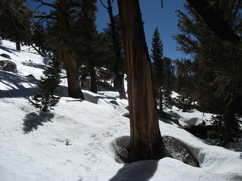
Snow
My attitude toward snow upon leaving Kennedy Meadows was that I didn't think it would be much of a problem. After all, as a Canadian, I walk on snow 4 or 5 months of the year. I hadn't anticipated two things. First, it is nearly impossible to find the trail when everything around is covered by snow, and second, a high amount of snow means a high amount of snowmelt. The second consideration would come later, but by our third day in the Sierra, we were very glad that the French Team had a GPS.
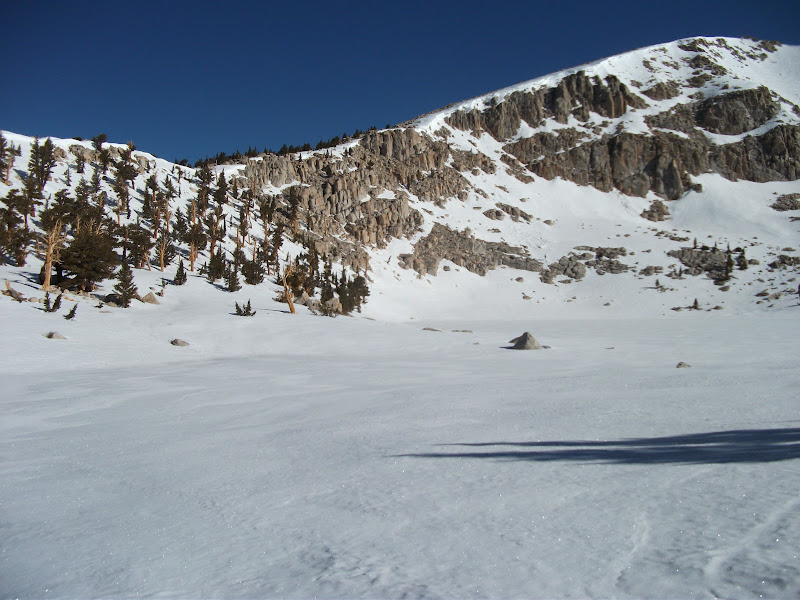
Early on the fourth day, we came to Chicken Spring Lake. The maps list it as a water source. This is what it looked like to us.
We started to learn how to "boot-ski". On slopes that are steep enough, you can let your shoes slip and then you start sliding down the slope. As long as the slope isn't too steep, you can go for quite a while and have a lot of fun. It also broke up the hiking a little bit, which was becoming a bit of a trudge. The snow was packed quite firm, but even the firmest snow is harder to walk on than dirt.
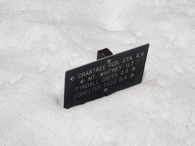
By the end of our fifth day, we got to Crabtree Meadows. I had been hoping to climb Mount Whitney (the highest mountain in the contintal US), and to do so we would need to take a side-trail. However, I had to balance that with my need to stay with a group. I was quite liking the group that I was with, and one by one, they decided not to attempt the climb. It was a hard decision, but I gave up on the idea of climbing Whitney as part of my PCT hike. With the benefit of hindsight, I am pretty sure that it was the right decision. The miles ahead were among the hardest I had ever hiked and I was nearly out of food. If I had needed to hurry, things could have gone terribly wrong.
Passes
The next day was all about getting close to Forester Pass. The consensus from hikers who had done the trail in previous years was that it was best to do the passes in the morning, before the snow got slushy. So we wanted to get close to the pass (the highest point on the trail) in order to do that.
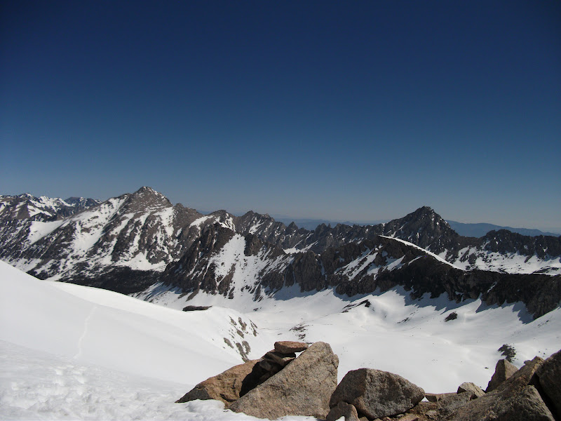
The hiking was starting to get spectacular. Everything was covered in snow and there were giant mountains all around. We only made it about 8 miles that day, but they were 8 hard-fought miles. Our large group found the last cluster of trees with snowless patches to camp in, and we ate a slightly early supper and turned in.
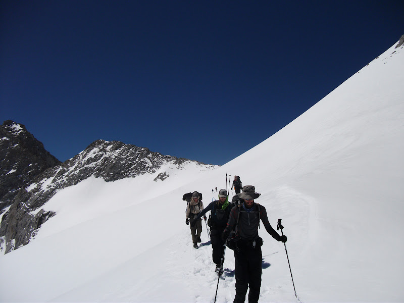
The weather was great the next morning, and we started out with great moods. This picture of Pyrite and Chinchilla walking toward Forester Pass is one of my favorites:
Eventually we got to the real climb before the pass. Unfortunately, I don't have any pictures that do it justice. It started off with a few hundred feet of what seemed like climbing straight up. There were steps in the snow that someone had made the day before, so I used those. I also had my ice axe out just in case I slipped or the snow gave way. At the top of the steps were some rocks. This was the actual trail, with switchbacks. The rocks were icy because the snow had melted the day before and frozen during the night. It was not fun climbing up them, but once I was up I was glad to be on the switchbacks.
The gladness didn't last very long. The switchbacks abruptly ended, crossed by a chute of icy snow. It was even more vertical than the steps we had just climbed, and as a bonus there were jagged rocks at the bottom. Any slip would give you almost no chance of saving yourself. To top it off, the snow was so hard and icy that the ice axe wouldn't go in. There were steps carved across the chute, but they seemed to have been carved by a giant. To say that I was scared when I was crossing them would be a massive understatement. It's not something that I want to do again. (It would have been much less scary if we had crossed in the afternoon when the snow was slushy, but that's something we didn't know at the time.)
Once I crossed the chute of death, it was just a few more switchbacks on terra firma before I got to the top. I had to sit down and hold my knees to get rid of the adrenaline that was flowing. The rest of the group caught up about five minutes later, and we celebrated being at the highest point of the hike.
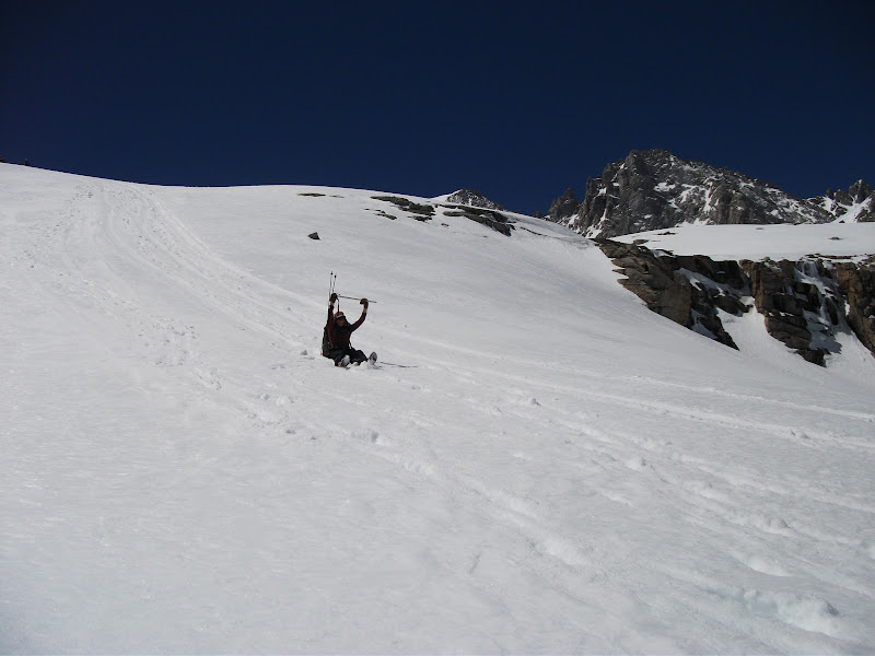
We started our descent from the pass and very soon got to do our first glissading. Glissading is a fancy word for sitting on your bum and sliding. It's a ton of fun.
We descended more than 3000 feet and then started climbing again. Our next day would take us into town, so we wanted to get as close as possible. We camped near Bullfrog Lake, and because campsites were so scarce, I camped quite a distance from the rest of the group.
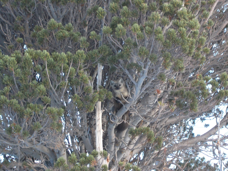
I awoke the next morning having decided that I was sick of the snow. It was causing us to hike too slowly and get too tired. I just wanted out. I started hiking without the group and got a little off trail. I did, however, get a picture of this fellow, who I think is a pine marten. He was quite curious about me.
I ended up a good distance above the trail and eventually saw the rest of the group pass below me. It was somewhat embarassing to climb down and catch up with them, but I was still glad to see them. We got to Kearsarge Pass without much incident, but the snow seemed treacherous again on the other side. We had to descend a long way from the pass to get to the road, and it was after noon by the time we got there. Eventually, we got a ride into the small town of Independence.
Off to Oregon
As I said, I had decided to get out of the snow. My strategy was to get to Oregon, where my mom and sister would be vacationing and then have them drive me back to Independence after a couple of weeks. I was joined on this road trip by Zombiefeet and Ryan, who had planned to end their hike at Independence and who needed to get to Washington for a wedding.
Getting to Oregon was a bit difficult logistically. The first thing
we did was hitch up to Mammoth Lakes. It wasn't an easy hitch, but
eventually a BMW  driven by a single lady pulled over and
gave all three of us a ride. It even turned out that we had
grown up in the same city, so we had something to talk about.
driven by a single lady pulled over and
gave all three of us a ride. It even turned out that we had
grown up in the same city, so we had something to talk about.
From Mammoth, we were able to rent a car. It's kind of strange driving after a month and a half of walking, but nevertheless I drove most of the way to Ashland, Oregon. I said my goodbyes to Zombiefeet and Ryan, handed them the keys, and was on my own again.
Oregon
Out of Ashland, I was happy to be on snow-free trail once more.
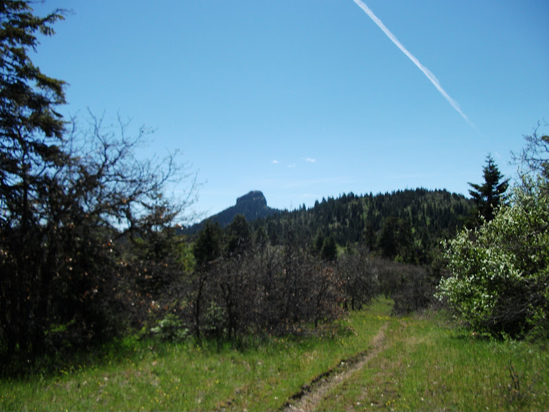
I was cursing my luck the same day when I came to a large patch of snow. It was easily crossed, though, and then the path was bare for a while longer. The next day had a climb, and the higher I went, the snowier it got. When I finally got to the top, it was as snowy as it had been in California. I was on my own without a GPS and I got lost. By this time, I was pretty used to the sensation of being lost, and knew that as long as I went down the mountain in the correct general direction I would be fine.
And that was the case. I slept on it, and found some snowmobile paths the next day. I followed them to a larger road and came out nearly on the trail. Later that day, I would come to so-called lava fields. Obviously, this isn't the molten rock of the movies, but it's the rocks that formed after cooling off. It's not too much fun to walk on because the rocks are awkwardly sized and shift constantly under your feet.
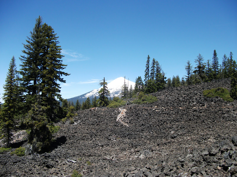
As you can see from that picture, I was coming to another mountain with plenty of snow. Since the whole point of coming to Oregon was to get out of the snow, I didn't feel like going into it. I called off my plan to keep hiking in Oregon and took a week off at my grandparents' house with my mom and sister.
Next Time
We drive back to Independence and I start hiking again. The rivers become harder to cross and I get lost some more.