The Whites
As a southbound hiker on the Appalachian Trail, you hear about the White Mountains from nearly the first day. They are reputed to be the Real Test – if you can make it past them, you can do anything. However, once you get to them, you have made it past Southern Maine, and you know you can do anything anyway.
To be honest, though, the Whites are a real challenge, and present a few peculiarities when compared with the rest of the trail. First, there are real buildings (unlike the shelters on the rest of the trail which generally only have 3 walls). These are known as "huts", but they're pretty nice. Thru-hikers are allowed to stay at them if they do a night's work, but they cost about $100 per night for everyone else. Also, there are many areas where camping is strictly forbidden, or where there is a fee to camp. This seemed a bit of a hassle, given the fact that I had been sleeping pretty much wherever I wanted for the past month. However, it's a high-use area, so I can understand the reasons behind the restrictions.
Leaving Gorham
Picker, Grinner, and I spent a nice day-and-a-half in Gorham despite a rather funny meal at a Mexican (perhaps that needs scare quotes) restaurant. "What kind of beers do you have?" "Oh lots, just name one." "Okay, I'll have a Long Trail." "I don't think we have that." "How about a Dos Equis?" "Nope." "Maybe you should tell us what you have." "We have Bud, Miller, and Miller Light." "I think I'll stick with water." And it went downhill from there.
The first two miles out of Gorham have beautiful pine trees and a really easy grade. They are probably the easiest two miles in New Hampshire. After this, we started going straight up again until we finally got over Mount Moriah.
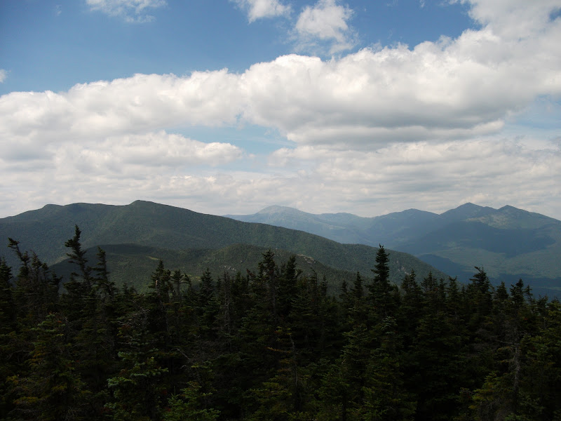
We got to a really nice shelter right at lunch time, and to my surprise Grinner wanted to stop for the day. I really wanted to go on, so after an hour of discussing the situation, I decided to go on by myself. I was a little scared because I had been with Picker and Grinner the whole way to that point, but I also knew that it might be a good idea, since I could be sure that I was going my own pace and not hurrying to stay up with them.
I walked about 5 more miles, not finding a camp spot (which was the reason that Grinner had wanted to stop), before finding a place to camp that was just outside the first big no-camping zone.
The next morning was up and over Carter Dome and then down to Carter Notch Hut. This was the first hut that I encountered, and gave me a good first impression of the huts. The croo (as the workers at the hut are known) was extremely welcoming and when they found out that I was a thru-hiker gave me some left-overs from the morning's breakfast.
After my short stop, I pushed on, up the Wildcat Ridge. This is a short mountain range with a ski area on one of the mountains. I stopped at a gondola and did a little people-watching while I ate lunch. After lunch, it was time for a knee-busting descent down to Pinkham Notch, which has a nice little interpretive center, where I think I got an ice-cream sandwich. (Thinking back on this, I guess I was getting plenty of food in this section of the hike).
The next four miles after Pinkham Notch were not too hard, but it was getting a bit late by the time I got to my final destination of the day – Osgood Tent Site. Bears are apparently a problem at this particular camp spot, so it was nice that they provided bear boxes to store our food.
Mounts Madison and Washington
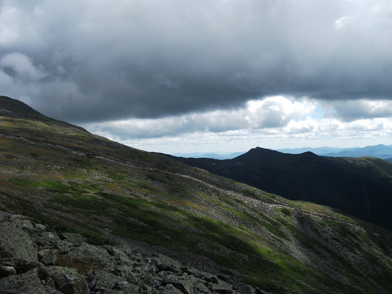
The climb from Osgood Tent Site the next morning is one of the longest and steepest on the trail. The trail climbs 2866 feet over 2.8 miles – a 20% grade that just goes on and on. Normally, when I got above tree line I was really happy because that meant that the climb was nearly over. On this climb, it lasted for at least another hour. I was lucky with the weather, though, and got some nice pictures. Here is one of Mt. Washington, as seen from Mt. Madison.
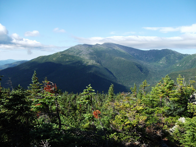
You can see the cloud on top of Mt. Washington (as well as the road up it). That is a nearly-permanent feature of the place that advertises itself as having the worst weather on Earth.
Here is a picture that is a bit more representative of the trail going up Mt. Madison:
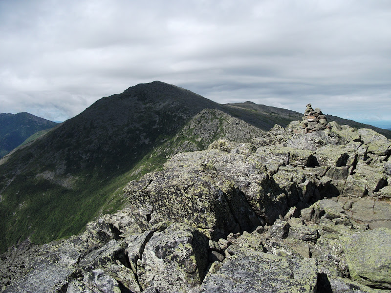
It is all large granite rocks, and the trail is marked by cairns.
By the time I had gotten to the top, I was really pretty tired, and I'd only been going for a couple of hours. Plus, the wind was beating fairly fiercely.
I descended to the hut and warmed myself up a bit, but was soon out the door, because I had a goal that was on the other side of Mt. Washington.
My afternoon that day was spent navigating large rocks and asking northbounders about the best method for getting work-for-stay at the hut that was just past Washington. The majority opinion was that the best method would be to hang out at the top of Mt. Washington until an hour before dark because the croo would not turn away a hiker into the dark.
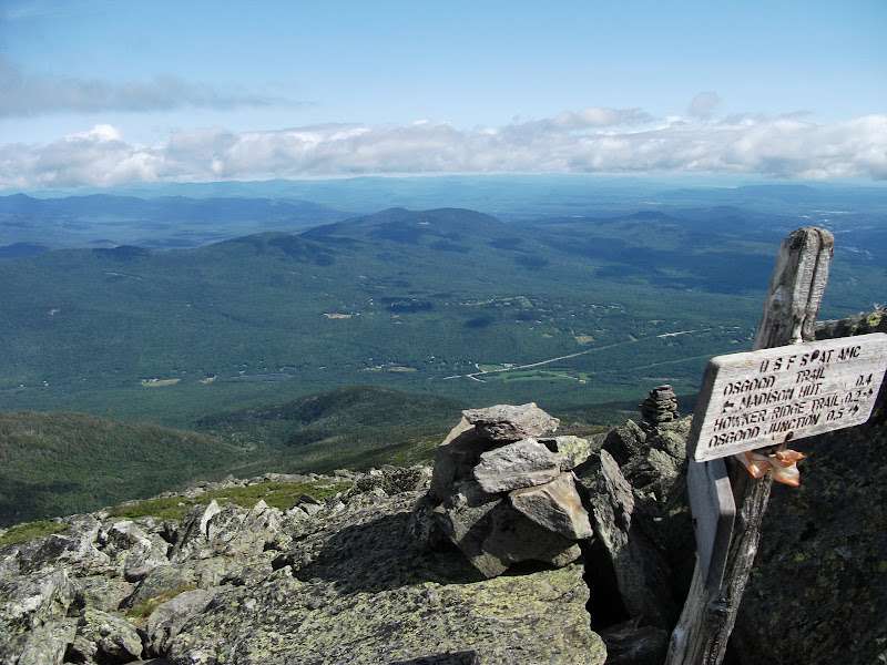
Before I got to Mt. Washington, I had to cross the railroad (for tourists only) that goes to the top. You can just see it in this picture:
But I eventually made it to the top. There were plenty of people who had ridden up in cars or the aforementioned railroad who would take my picture with the summit sign.
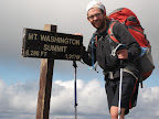
The top of Mt. Washington is a fairly strange place. It is a major tourist attraction, and has a large snack bar, gift shop, and post office, but it also has a major weather station measuring just how bad the weather can get. Every now and then, someone dies because they venture out on a hike without the proper gear.
However, I was safe and sound at the top and hanging out at the gift shop until it was late enough to go to the hut. I met up with a guy I had seen in Gorham, who had the trail name Bar Man. He was a bit out of place in the hiking community – older than the average hiker and far less outdoorsy. In the time that we were talking, it emerged that he had only hiked from Osgood Tent Site to Madison hut the day before. Since I had done that hike in the morning, I was less than impressed.
We walked down to the hut, with the lyrical name "Lakes of the Clouds" just before sunset. There were many other hikers that had already arrived, but as predicted, they took us in since darkness was falling. That evening, Bar Man made a nearly complete ass of himself. He was completely rude during supper, complaining about everything, despite the fact that we were staying and eating for free at a place where others were paying quite good money to stay. He did as little work as possible, and relentlessly hit on the pretty northbound hikers. I made up my mind to get up early and leave him behind.
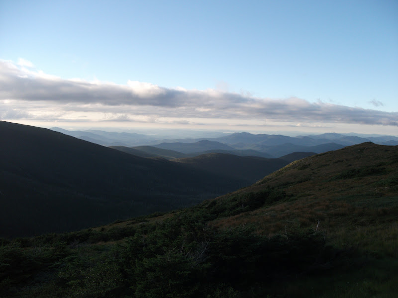
After sleeping on the dinner tables of the hut, I was very glad to get up early. It turned out to be a lucky decision, because clouds had dropped beneath us, and the views were great.
The path from Mt. Washington was relatively easy – I could have easily made it to the next hut the day before – but before long, it got hard again. During a moment of lack of focus between Mt. Jackson and Mt. Webster, I had my trekking pole slip on a rock, and I fell flat on face. It was a good reminder to keep my concentration up.
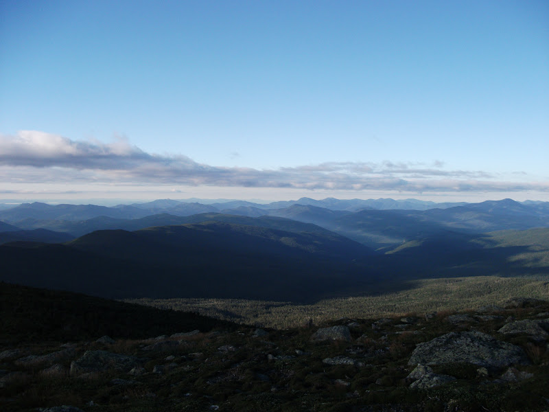
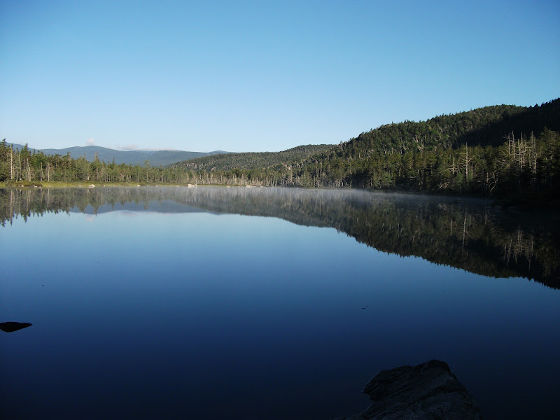
After a descent into another notch, I ascended back to nearly the same elevation, and made my way to Ethan Pond. The caretaker at the campsite was a really nice guy and waived the fee for me as a thru-hiker. He also told me that the camp site where I had set up my hammock was a favorite place for a local moose. I didn't see the moose, but I did get a nice picture of the lake.
Wrapup
This post is getting a bit long, so I'll save the southern half of New Hampshire until next the next post. In it, I nearly get arrested, finally finish with the Whites, and rub shoulders with the blue-bloods at Dartmouth.