Damascus to Erwin
I had a great time in Damascus with the little crew that I had met up with a few days earlier, but they wanted to stay in town a little longer than I did, so I went on without them. The first day out of town, I had a certain shelter in mind to end at, but it got dark before I got there and, having no desire to night-hike, I simply stopped in the middle of a hill and set up my hammock. I'm fairly sure that was one of my most random campsites. I didn't think it looked any good as a campsite, but I was tired and wanted to stop.
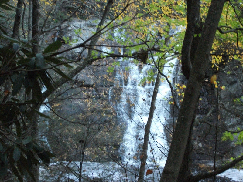
Laurel Fork Falls
Maybe my thinking was skewed by the fact that I knew that if I could hike 25 miles per day for the next four days, I could stay at a hostel for each of them. The first of these days took me to the Kincora hostel, home of Bob Peoples. Bob is a trail maintainer in addition to being a hostel-keeper, and is a trail fixture. Most of the graffiti in the shelters leading to his hostel consists of Chuck Norris-style jokes about him (all complimentary of course). He has been running the hostel for over 20 years and still only charges $4 per night. While I was there, we sat and chatted a bit. He told me about his previous hike in Europe and his plan for the next summer to work on the International AT in Canada, adding cairns so people can find their way in Newfoundland. For an older guy (he must be nearly 70), he sure gets his kicks on the trail.
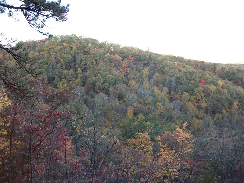
The leaves by this point had all turned, and most of them were brown. There were a few patches of color left, though. For the most part, I was still in the "tunnel" of trees and branches, but the falling leaves gave some more opportunities to see outside it.
The next night I made it to the next hostel. This was the Mountain Harbour Hostel. They have a room above a barn that is really nice, but unfortunately it was booked by the time that I got there. I did use it to shower in and watched City Slickers (a great trail movie by the way) before going to bed in an RV. It was comfortable, but not as neat as the barn.
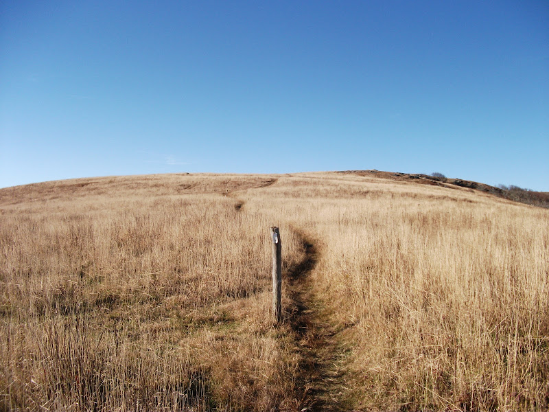
The next day started with a big climb up Hump Mountain. It is the first of the "balds" that a southbound hiker hits.
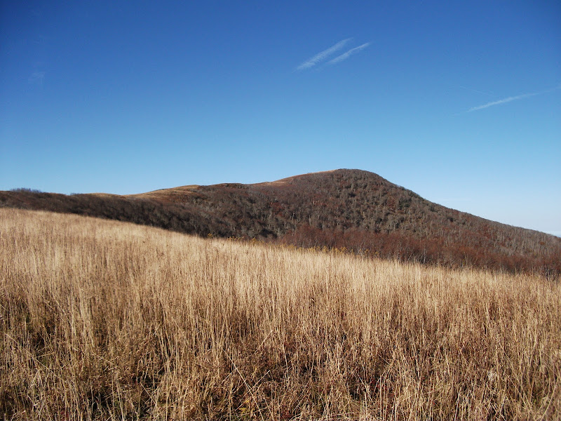
As you can see, there are no trees – it is just long grass. After nearly 1800 miles of nearly consistent tree cover (and alpine terrain on the tops of mountains), this is a welcome change.
Eventually the trail goes over 6000 feet elevation at Roan High Knob. There is a shelter at the top, where I am sure it gets quite cold at night, but I wouldn't know because I wanted to get to the next hostel.
The next hostel was not a hostel but a "friendly" (get it? hostel… hostile… friendly (it's not a great joke)). The proprietress, who was quirky but nice, wasn't there when I arrived, but she left a key so that I could get situated and watch a little TV. She cooked me a great breakfast the next morning and I was on my way to the next one.
The weather that day was rainy, and I got to use the rain jacket that I had purchased in Virginia for the first time. Going up some rather high mountains in a thunderstorm wasn't so fun, but I was on a mission.
Luckily, the rain didn't last long, and soon it was a mere memory. I kept pushing on and made it to Erwin, TN by mid-afternoon. The hostel in Erwin had a bunch of old guys just hanging around. I might have found them amusing under other circumstances, but as it was I just found them (and Erwin by extension) a little sad. I got a resupply that evening and was out early the next morning.

Sad.
Erwin to Gatlinburg
Out of Erwin, there is some significant climbing, and that combined with the threat of rain conspired to stop me after only 16 miles. I was glad to have stopped, because it did rain that evening and some the next morning as well. Once again, the rain cleared up by the afternoon, and by the end of the day I was happy to be walking down the trail. At the end of the day I came upon Hot Springs, NC. It was dark by the time I found the hostel that I had heard about. It is run by a Buddhist monk who makes gourmet vegetarian food. Naturally, I took a zero there.
By this time, I had done the math and determined that I could finish on my birthday if I kept a decent pace. The zero set me back a little bit, so from then on I needed to really push: the only thing in my way was the Great Smoky Mountain National Park.
I met up with Skittles again the day after I left Hot Springs. He had a bit of a falling-out with the rest of the group (as I understood it) and had hiked ahead of them. It was nice to be around someone that I knew again, but we had such radically different paces during the day that we were never around each other for very long.
The next day ended just inside the national park at a shelter that had a chain-link fence enclosing it to keep the bears out. There was a group there, and after a while it became clear to me that they were a church group. Skittles showed up late and he never got the memo. The next morning, he went with them to the top of a mountain off-trail (there were a couple of pretty young ladies in the group, and he thought he had a chance) and only found out then. As he told me, he was pretty mad when he found out and spent a couple of hours arguing with them about the existence of God.
I, on the other hand, went to a shelter half a mile off the trail and spent the night alone at a mile high. There were bear warnings all over, but I didn't see one.

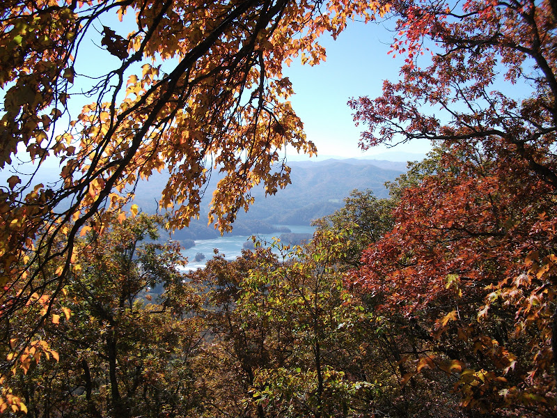
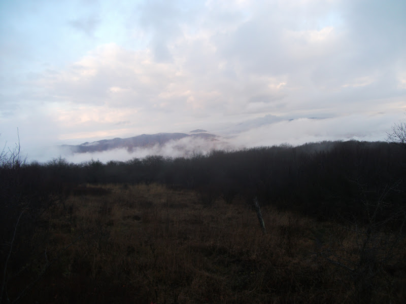
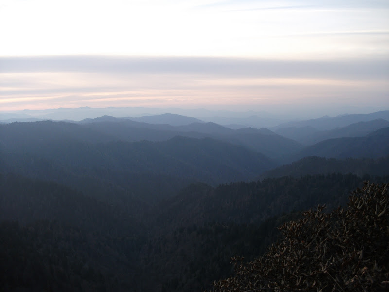
I love views where the mountains seem to be stacked one behind the other. The Smokies had that in abundance, and the haze in these photos really shows where they got their name.
I was only about 10 miles from the road Gatlinburg, and got there easily by noon. Despite the throngs of tourists, I wasn't able to get a hitch for over an hour (and even that was in the back of a pickup truck – not fun for 15 miles at 60 miles per hour).
Gatlinburg is a strange place. It's now overshadowed by Dollywood, but it was once the premier tourist destination in the area. As such, it has everything you wouldn't expect: a Ripley's Believe it or Not, cable cars, a wax museum. The only thing that isn't accessible in town is a grocery store. I had to wait for a bus to take me out of town and back in order to resupply. By the time I had gotten everything that I needed, it was getting pretty late, so I decided to stay in town. The one advantage of it being such a touristy town is that there are many motels, and they're all pretty cheap.
Gatlinburg to the border
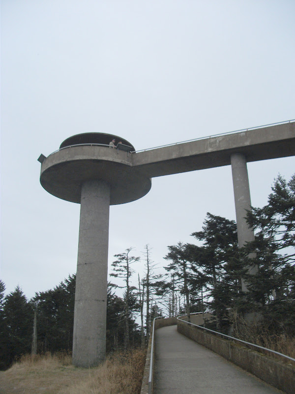
I got picked up by a guy going back to the trail to do some trail maintenance the next day. Soon after getting dropped off, I hit the highest point on the trail – Clingman's Dome. For some reason unknown to man, there is a completely ugly structure on top.
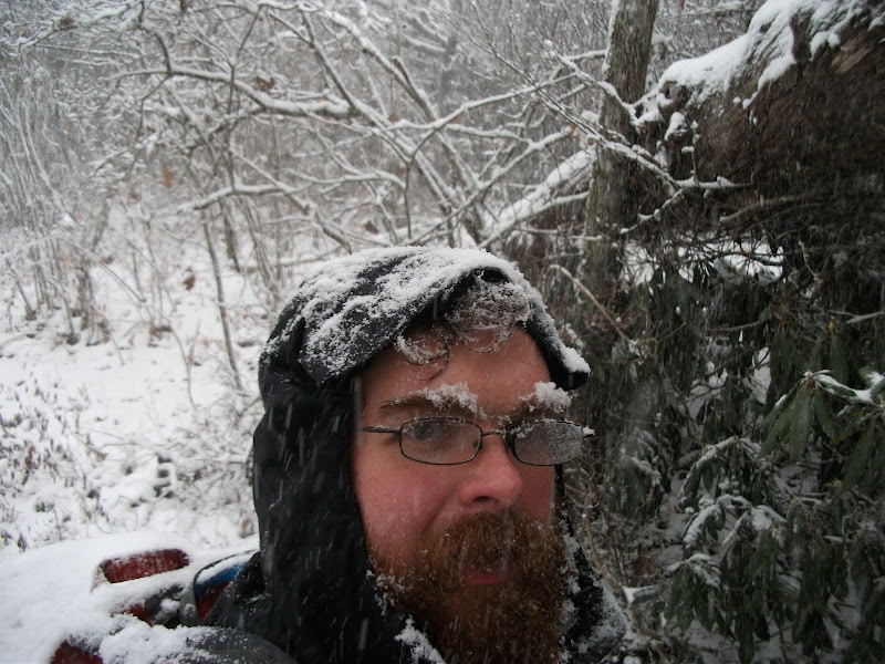
The hike was all relatively downhill from there. The next morning it snowed for the first time on the hike. At first, this seemed exciting and fun, but it really was just a colder version of rain. I stayed at a shelter called the "Fontana Hilton" that night, so called because it's a large shelter near the Fontana Dam. It's nowhere near as comfortable as a Hilton hotel, though, and it was packed for the night.
The next day was even snowier.
The snow didn't slow me down too much, because I was on a mission to get to the Nantahala Outdoor Center. I hit a shelter full of people at about 5 pm with about 7 miles left to go before I got there. I didn't even hesitate about staying at the shelter. I knew that if I was going to make it to the end by my birthday, I would have to do the miles that night.
I eventually did make it to the outdoor center, after a little bit of night-hiking. I am almost always against the idea of night-hiking, but it really is magical in the snow: everywhere that your headlamp hits just sparkles. I was really glad to be inside that night – it snowed more and got quite cold outside and I was snug inside.
The next morning was still cold, so I went and bought a cap at the outfitter. It was a good thing that I did too, because I was cold almost all of that day. That night it got the coldest that it ever was on the trail. My sleeping bag, rated at 0 C (meaning that I should be comfortable all the way down to that temperature) was really not warm enough. I slept in all my clothes and had just my nose poking out the top. It was cold.
Thankfully, that was the coldest night that I spent on the trail. The sun came out the next day and never went away again. I passed the point where I only had 100 miles left and at that point I was pretty certain that I would make it. I had 4 days left until my birthday, and I was also pretty certain that I would make it by then. Thinking back to the beginning of my hike, that would have been hubris, but now that I had gotten near the end, it really was justified confidence. That said, there were some tests to come, but no more in North Carolina, because I was almost out of there.

The final state line
Next Time
Georgia. The last state on the trail, containing the final challenge for my hike.