Section C ended with a couple of rainy days before a night at a Best Western at Cajon Pass. It was a restful night, and before long we were on the trail again.
Cajon Pass to Wrightwood
Most passes on the trail are higher than the trail around them, but Cajon Pass is the opposite. So we had another day of climbing ahead of us. This day was more than 5000 feet over about 22 miles. So not very steep, but still a grind.
As I went higher, the landscape changed from desert and chaparral to more of a forest. It also became clear that we were reaching elevations where it could snow if there was any precipitation.
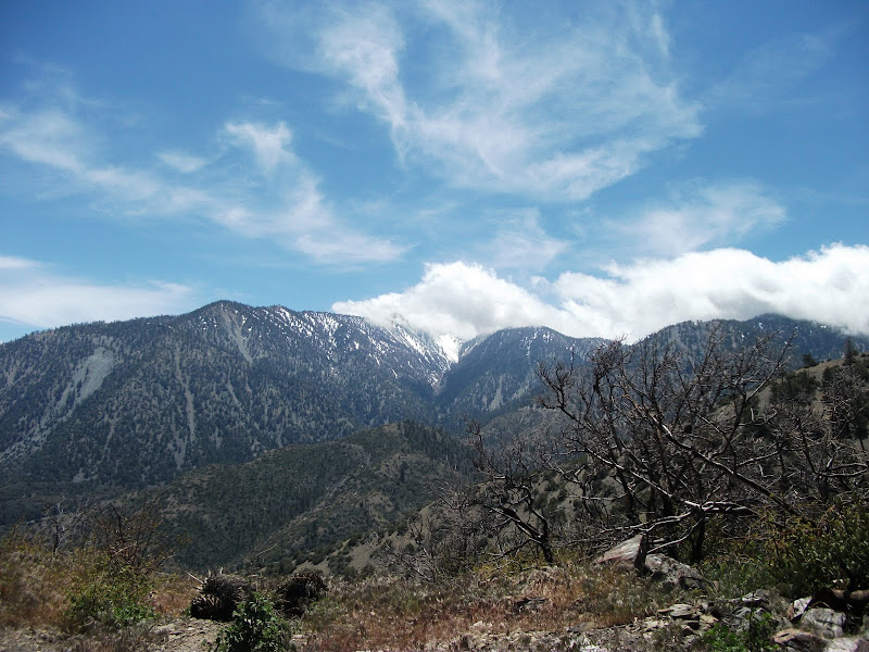
Given that we had had bad weather over the past couple of days, this was a real concern. The picture above has clouds in it, and I was monitoring them all day. The plan for the day was to end near a trail going to the town of Wrightwood and then to spend the next day in Wrightwood. If bad weather hit, we would go into Wrightwood that night.
What happened was a bit more complicated than that. When we got to the top of the hill, the weather wasn't great. The wind was blowing fiercely, and it was cold and cloudy, but there was no precipitation. Morevover, we were at a campground with an outhouse that all the campers could pile into if the weather got truly awful. Even though the outhouse didn't smell great, we would do it if we had to.
We didn't have to, but I awoke the next morning to freezing rain. On the trail, I'm generally an early riser, so I was out of camp before the others that were camping at the site with me. Even though the trail to town was behind us, I decided to hike to the road that was about five miles ahead of us. I guess I was in a bit of a masochistic mood.
As I walked down the trail, ice balls as big as cantaloupes fell from the trees around me. The freezing rain was accompanied by a strong wind, and it felt like someone was sandblasting my face.
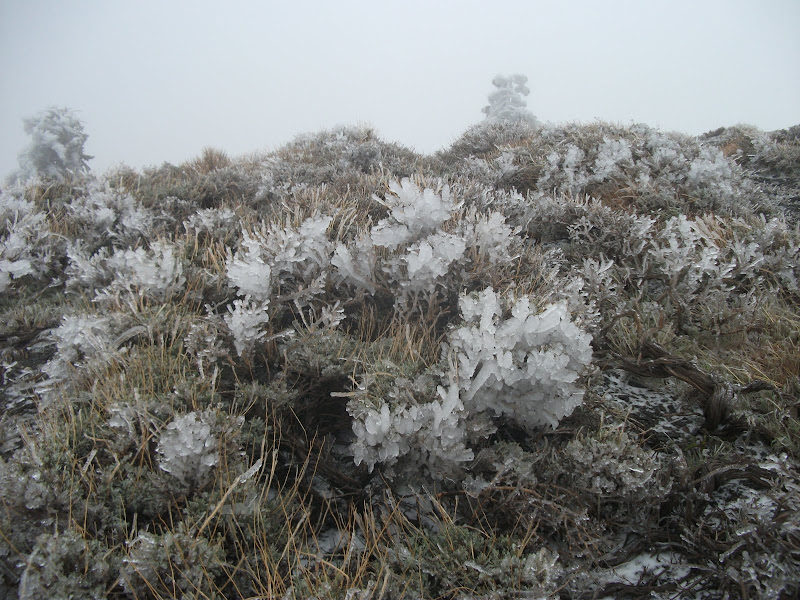
After a while, the trail was covered by snow and ice, and staying on it became more difficult. At one point, I kept going straight after it had turned and ended up at a ski hill. There was a nearby maintenance shed, and I stood in its wind shadow to warm up a bit and read my maps. I was near the trail, so I got back on it. After another half mile or so, I was still at the ski hill, but I found a warming shed. The ski hill was closed for the season, but the heater in the shed still worked, so I had a chance to warm up for real.
At that point, I knew I had two options. I could either try to stay on the trail, or I could go down the ski run that I was sitting at the top of. It is a truism that if you go down a ski run, you will eventually find a road at the end, so I knew that would work. As I said, I was having trouble staying on trail, so it was an attractive option. Looking back on it, going down the ski run would probably have been smarter, but I decided to try to stay on the trail.
I did get slightly lost a couple more times, but eventually I found my way to the road. As I descended, the weather got better (just rain and not freezing rain), but I was still pretty cold and wet by the time I got there.
Unbeknownst to me, the road was closed in the direction that traffic would be coming towards town, so hitching was really hard. Since I was cold and wet, I decided to keep moving, and walk towards town. A few miles down the road there was an intersection which meant that finally there would be traffic in the correct direction on the road, so I got a hitch the rest of the way.
I had a nice time in Wrightwood, where I stayed in a room with Holden and (Head)Banger. We went out for Mexican food at a place that advertised 5 cent margaritas with your meal. Of course, only the first was 5 cents, but Holden didn't realize that. Or perhaps he didn't want to realize it because it was his birthday. In any case, he had quite a few of them, and it was a pretty fun night.
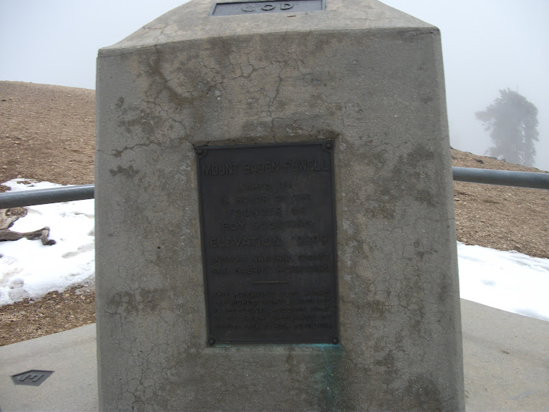
Mount Baden-Powell
After a large pancake breakfast, I got a ride back to the trail. The first half of the day was flat and easy, and then I got to Mount Baden-Powell. Initially, it was easy too, though steeper than most of the trail we had encountered so far, and then I got to the snow. Even that didn't seem too bad – someone had gone up it on skis, so the trail was easy to follow. I met another hiker on the way up (I can't for the life of me remember his trail name), and we decided to stick together going up the mountain.
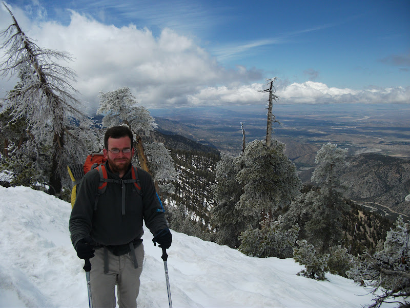
Near the top of the mountain, the PCT turns and traverses the face of the mountain, and another trail keeps going to the top. Traverses are scarier to me than ridge walking, so we took the trail to the top.
Now here is where things get funny. As you can see in the picture above, there was quite a fog that day. So, following footsteps rather than our compasses, we went down the wrong ridge. In the picture below, we were supposed to follow the red line, but we followed the orange one instead.
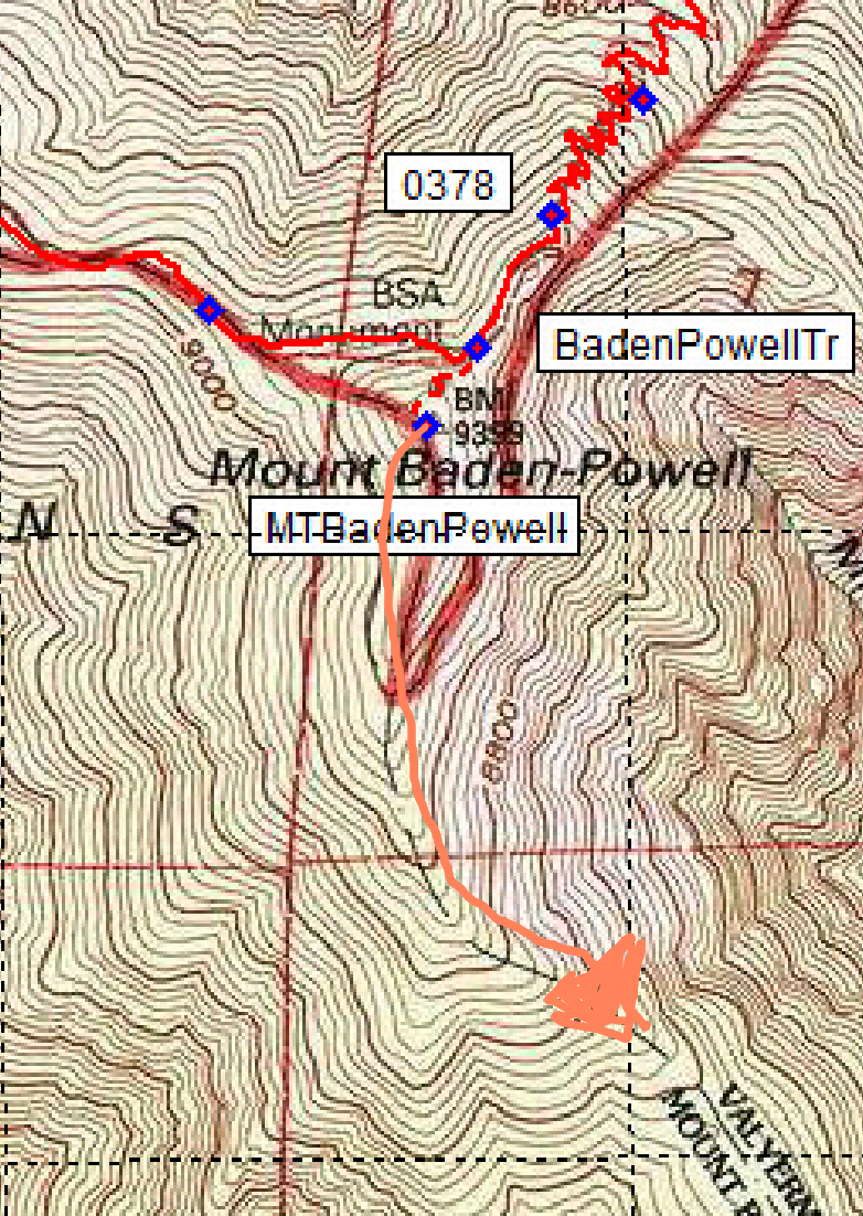
knew that we were lost. What we didn't know was just how lost we were. We started scouting around for the trail, going back to places where we had last seen footprints, and following animal paths to dead ends. By the time we got our compasses out, we were off the map, but it didn't matter. It was clear that we were going the wrong direction.
Before we figured out exactly what had happened, Garby happened upon us. He had gone down the path to Wrightwood rather than the road, so he had been a few hours behind us all day. He had seen our footprints and assumed that we were going the right way. So now there were three of us that were lost.
Once Garby showed up, though, we figured out what had happened pretty quickly. It was clear that we would have to walk all the way back up Mount Baden-Powell, and go down the correct ridge. By this time, however, the sun was setting, so we needed to camp. It was a new experience for me, camping while lost. It was not particularly pleasant. I remember getting up during the night and seeing that the fog had cleared. The moon was bright, and I could see the ridge that we needed to walk down.
We were all up early the next morning, partly because we wanted to be back on the trail and officially un-lost, and partly because we were all almost out of water. We hiked back up the mountain and down the correct ridge to a beautiful spring, with water coming out of the side of the mountain.
Podcasts
Let me take a quick diversion here to talk about the process of hiking, rather than the journey. On the AT I resisted technology for a long time. On the PCT, however, I started the trail with an mp3 player. I would charge and refill it with podcasts every chance that I got. Some people hate any technology on the trail (except all the technologically-advanced stuff that they carry on their back, but I digress even further), but I think that listening to podcasts really helped me cement the experience in my brain. I have trail memories triggered by my favorite podcasts all the time.
I can picture exactly where I was when I was listening to the guys on The Bugle make fun of the hype surrounding the royal wedding. And now, whenever they mention it, I picture that place. When I was going up the hill out of Cajon Pass, I was listening to an interview on Fresh Air with a couple who filmed lions. On the way down Mount Baden-Powell, I was listening to Tig Notaro on Jordan, Jesse, Go. I heard Tig on another podcast the other day and immediately thought of the whole experience. Even more than a year later, these are completely vivid memories, and I think the fact that I was making mental connections between what I was listening to and the place that I was hiking through helped that.
So anyway to distill it to two words: podcasts good. Just always have one earbud out if you are walking in a place that could have snakes.
Frog Detour and Station Fire Burn area
The next couple of days are a bit of a blur (though I could tell you what I listened to). It was a beautiful area, but perhaps the slightly traumatic experience of getting so lost pushed the memories out of my head.
One thing that does stick out is a long road walk to detour around the habitat of an endangered species of frog. I later heard that horseback riders are likely more damaging to the frogs' habitat than hikers, so I would have been fine going through the detour, but I did the detour in any case.
The day after the frog-detour day, the trail went through the burn zone of the Station Fire. An act of arson, this fire had been so bad that it burned down the ranger station. They were rebuilding at the time that we were there, which is a good thing to see, but a burn zone is a pretty sad thing for me.
Boris
In the last section, I mentioned that there was a funny story with Boris and LoL. Around the frog detour, just past Mount Baden-Powell, LoL went into the bushes to go to the bathroom and Boris passed him without LoL knowing it. Boris was in the zone, moving fast, and even though he and LoL had been hiking together, he didn't wait around for LoL. With his head down, he even missed a turn and went a little way on a wrong path before realizing it and bushwhacking down to the correct path.
After half a day of not seeing his buddy, LoL got concerned. Assuming that Boris was behind him, LoL decided to wait for Boris. When he got word from hikers behind him that they had seen a place where a hillside had been torn up and it looked like someone had fallen down the mountain, LoL had all the reason he needed to panic and call in search and rescue. They sent a team to the place where the possible fall had been seen, but found no Boris. They had sheriffs go to all the campgrounds in the area and yell his name (one of them woke me up).
Boris was at the same campground as Garby, about 10 miles ahead of me, and had no idea that so much was going on in his honor. When he found out, he was mightily embarrassed, and that's how he got his trail name of Overdrive. My theory is that he didn't want to be associated with the name that the sheriffs had been yelling.
Vasquez Rocks and Hiker Heaven
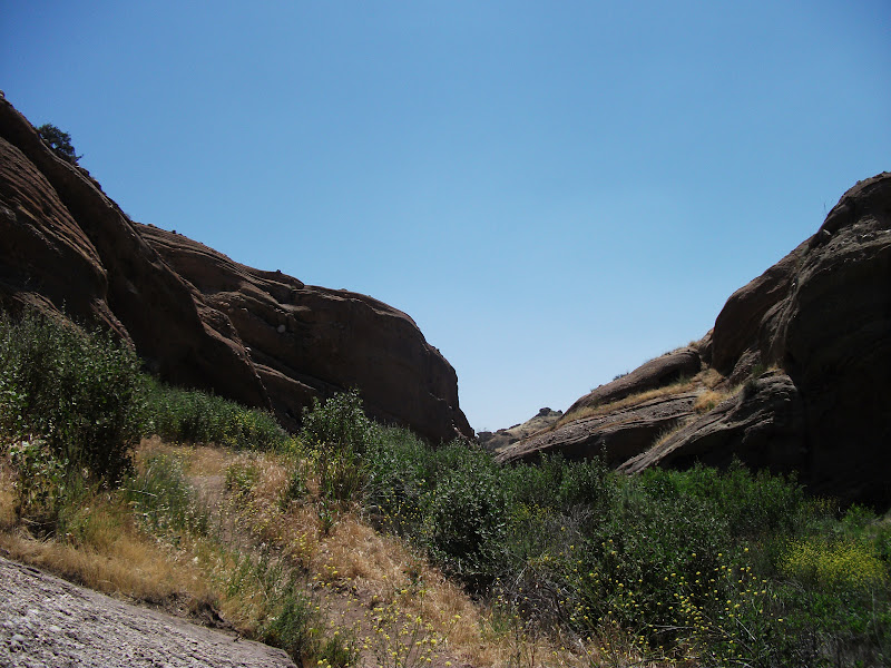
It had been an eventful section, and there were two last treats. The first was the Vasquez Rocks. Huge weather-worn rocks sticking out of the desert, they epitomize what I think of as a western scene. For good reason, it turns out. They have been used in quite a lot of movies and TV shows that want to have a "Western" location.
It is quite a touristy location, to the extent that they even have placards along the path identifying the flora. I was a bit surprised to see that they even had one identifying poison oak. I would think that it would be easier to remove the poison oak than to put up a sign saying what it is, but I guess that shows what I know.
Hiker Heaven
Just past the Vasquez Rocks is a hostel appropriately named Hiker Heaven. It's run by the Saufleys, who are a great couple who happen to have a large yard and love hikers. I took a zero there, and got a ride to an outfitter near LA where I got a couple of things that I had been needing.
Next Time
Into the real desert. Night-hiking to avoid the sun. Going by another wind farm. Feeling sick.