The last post was getting a bit long, so I split it into two. When I left off, I had just finished the last big mountain pass on the hike.
Yosemite
The Yosemite Valley is a truly amazing place. There are massively high waterfalls all around, as well as giant stone walls. Half Dome is like a giant rock that has been stuck in the earth and then split down the middle. But there are roads to the Valley, and it is a famous place to go. So it is full of people.
I hung out and set up camp with the new group that I was joining. I had met all of them earlier in my hike, but I had done quite a bit of hiking with Liz and Skinny D. So we caught up and I learned how people were doing. Garby was now known as No-Knees due to a glissading SNAFU where the snow rubbed the skin on his knees right off. He had also crossed Evolution Creek at a place where the water was up to his neck. Raven and Lovebird were ahead, but maybe catchable.
The next day, Skinny D told us that she had gotten an offer of a ride around the next few sections where the water was supposed to be really high. We tried to talk her out of it, but she had pretty much decided. It put a damper on my enjoyment of the rest of the day because I quite liked having her around. We did our final bit of shopping and took the bus back up to the trail.
We slept that evening essentially where the trail crosses the road. We bade Skinny D goodbye and good luck the next day and then set off toward the rivers that we had heard so much about.
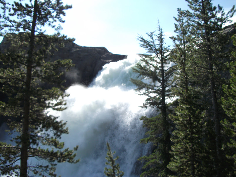
The first was the Tuolumne River. We had to cross it twice, but there were bridges. However, much of the bridges were underwater. There was a huge waterfall followed by a pool that had so much water in it that it looked like the ocean. It was a good sign that the amount of water in this section was going to be dreadful.
After that came Return Creek. Two experienced hikers had already written a note to the PCT mailing list saying that they couldn't make it past Return Creek, so we were ready to turn around there if we needed to. When we got there, we found water three or four feet deep that was moving like a waterfall. I knew that there was no way that we would cross it there, so I started walking downstream. About a mile away from the trail crossing, I found a place that looked okay to cross. I got the group (along with Bert and Ernie, who had shown up while I was scouting) and together we went to the crossing. Bert and Ernie actually found a log jam a little way past the crossing that I had found, so we took that. In the end, we didn't even get our shoes wet in Return Creek.
We had to bushwhack back to the trail and when we got back, it started raining. We walked a few miles more and then got to Matterhorn Creek. The rain had filled the creek by the time we got there, but we were wet anyway, so we tried to cross. That wasn't a good idea. We looked for the shallowest part of the creek and all got in together, forming a square. The idea was that we would move across the creek by rotating. I started out as the upstream side of the square. The current swept me right off my feet and we had to go straight back to the bank. So in a sense, our scheme worked. We tried to cross, found it impossible, and turned back in an orderly manner. We camped on the side of the creek.
The next morning the creek was down by about a foot and we crossed easily at the trail. We climbed Benson Pass and then descended to Piute Creek. This was another wide, deep, and slow-moving creek. It was also very near the lake that it flowed into, so it seemed like we were walking through it forever.
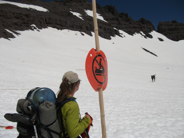
After that, up and over another big hill. On the other side, we entered Kerrick canyon. The map also claims that Kerrick canyon is a difficult ford, and boy did it ever look true. The water was raging beneath us as we traversed the snow-covered hill. I got out my ice axe, thinking that if I slipped, sliding down into the water below would be pretty bad. We finally got to the end of the canyon and the terrain flattened out. The water was still moving fast and we knew that we would need an alternate way to cross. We found a tree that had fallen across the river. It was smaller than most logs we had used to that point, and it still had nubs of branches sticking up, which made walking across it harder, and it was also partially submerged. In short, it wasn't great, but it was all we had. Luckily, we all made it across without falling in.
A couple miles later was yet another ford. Deep and slow-moving, if we had crossed at the trail, our feet would not have hit the bottom. Instead of doing that, we went upstream a bit and found a nice place that only went up to our bellies.
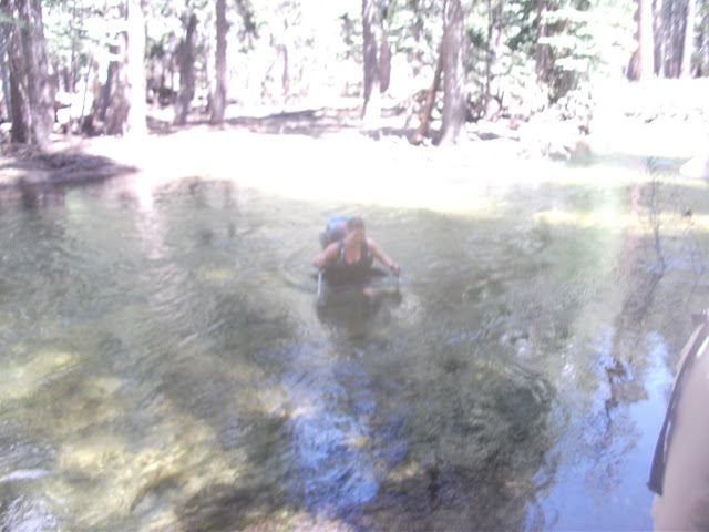
Next, we came to another ford at Falls Creek. It was starting to get late in the day, so we hoped to get across it and make camp. Unfortunately, it would have been another swimming situation, and that just isn't my style. As we got closer to the creek, we knew we were walking on the trail because we came to a bridge between the creek and the lake that adjoins it. However, we had been walking with water up to our knees for minutes! To warm up, we climbed out of the water and onto floating ice. The whole thing was crazy.
After seeing the amount of water at the trail crossing, we decided to go upstream the next morning. It worked out pretty well until we got to a tributary. Maybe it would be more accurate to call it a series of waterfalls all joined together in a giant maze. Crossing it was like a video game. First we took a log about halfway. Then up a little. Across the main channel behind a big rock. Then down a little, followed by some rock-hopping to the other side. Finding this sequence took about an hour (you obviously don't get the option of restarting the video game if something goes wrong, so you want to get it right on the first try), and by the end, we were so cold that we had to sit in the sun for half an hour to warm ourselves.
Of course, we had just crossed the tributary. Another group had caught up with us as we crossed the tributary, and because they followed our route, they didn't spend as much time in the water, so they went ahead to look for a way to cross Falls Creek as we warmed up. Eventually, we saw an arrow in the snow that they had drawn and found a nice section of the creek that was only about three feet deep the whole way across. The bottom was slippery, but we made it.
That was the last of the major fords. We still had wet feet for the next few days, but it started to feel like regular hiking and not some demented water park once again. A few miles after Falls Creek was mile 1000. We posed for a nice picture.
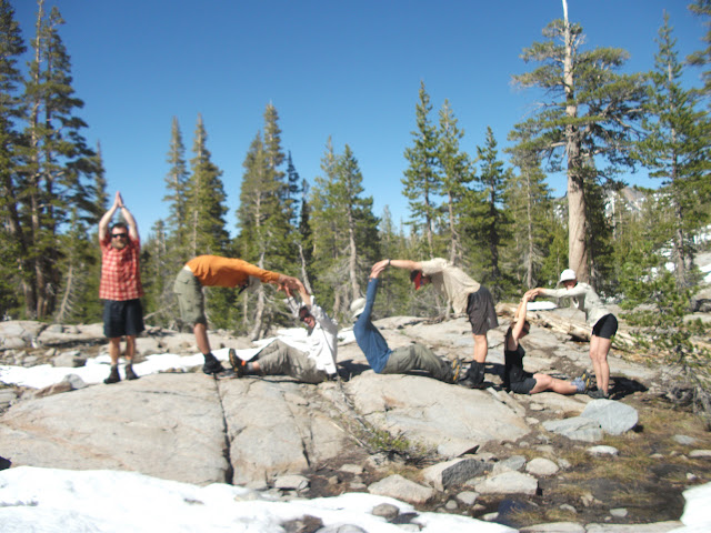
(From left to right: K-Bomb, Spice Rack, [someone whose name I forget], me, Funyan, Liz, and Meow-Meow.)
Sonora Pass to Tahoe
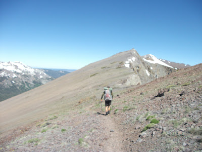
Liz's boyfriend's parents live near Sonora Pass, so our goal was to get there the next day. In the morning, we climbed to a ridge, and then the rest of the day (until the very end) was walking along that ridge. I guess I was happy to get past the difficult fords, because I took a lot of pictures.
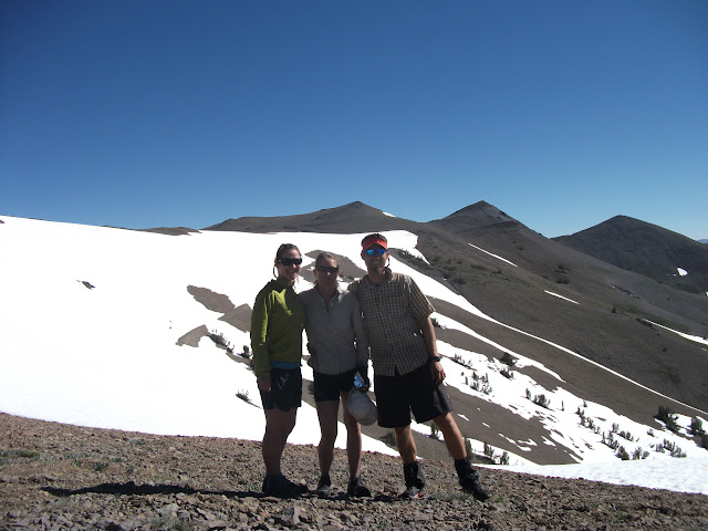
(Left to right: Liz, Meow-Meow, and Funyan)
We glissaded down from the ridge, losing about 500 feet of elevation in a matter of minutes, and then hitched down to town. We met up with Liz's boyfriend, and I spent a comfy night on his parents' couch after the usual shower-shop-eat cycle.
We spent most of the next day in town as well, and went up to the pass only in time to make camp right at the road. The next morning, we went over ten thousand feet for the last time. The snow was starting to diminish, and we were glad for every step on dirt. Our mileage started increasing as well. We completed the 90 miles between Sonora Pass and Echo Lake in four days. Once we were at Echo Lake, Liz had some family in the area, and we stayed with them. We went into the town of South Lake Tahoe, and finally got rid of our bear canisters and ice axes.
Next Time
I go out on my own again into Northern California.